Failure
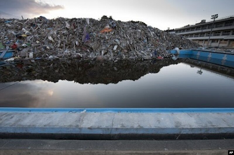
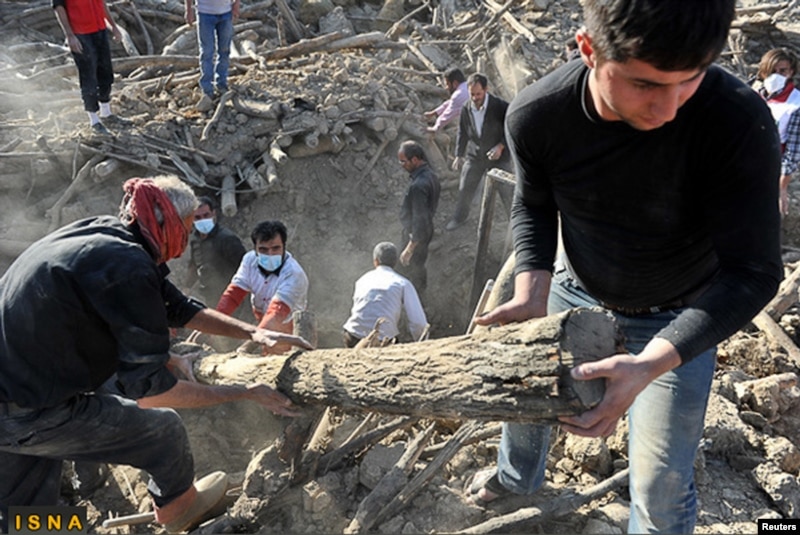
Three recent major earthquakes: in Sichuan, China in 2008, in the Caribbean nation of Haiti in 2010 and in northeastern Japan last year - have led to what some scientists acknowledge is an embarrassing failure.
They did not foresee such intense tremors would cause widespread destruction and casualties in those specific locations.
Earth sciences professor Seth Stein at Northwestern University in Chicago says that was a sobering day for his field.
"One, our ability to assess earthquake hazards isn't very good," noted Stein. "And, second, the policies that we make to mitigate earthquake hazards sometimes aren't very well thought out in terms of whatever tens or a hundred billion dollars were spent on those tsunami defenses were largely wasted."
Expect the unexpected
Tokyo University seismologist Robert Geller is among co-authors, with Stein, of a new article intent on debunking some standard assumptions in their field, such as earthquakes occur in cycles.
"Many earth scientists still continue out of intellectual inertia to use terms like 'seismic cycle' or 'characteristic earthquake' or 'earthquake cycle" or things like that. So we've become prisoners to some extent of terms we use," explained Geller. "It's time for the field of seismology and earthquake science to rethink some of the basic precepts."
Geller says his colleagues around the world need to re-learn "to expect the unexpected" when it comes to earthquakes.
"Unfortunately we don't, at the present time, have the scientific ability to make specific predictions in their immediate advance, or, let's say, years in advance," he said. "All of those various kinds of predictions have in fact been made, but they usually don't work out."
Geller has a closet filled with publications, produced by scientists and charlatans alike, proclaiming earthquake forecasting methods, all of which he has made an effort over the years to debunk.
Limitations
"Now we've got these maps out there. Every country has a government agency that makes these maps and engineers look at them," Stein noted. "There's some good sense in them, but there's a lot of problems with them too and the uncertainties in there are a lot bigger than we use to think they were."
Geller sees some of those hazard maps as a hazard, themselves.
"They're based on one assumption piled on top of another. If you treat them as being something you can literally rely on as extremely accurate then you're in trouble," he said.
Better maps
That has led to a greater awareness about creating better hazard maps and the scientists are trying to figure out how to do that.
Meanwhile, Stein acknowledges that nature has the upper hand.
"We're playing a game against nature. It's a very high stakes game," Stein said. "We don't really understand all the rules very well. We need to very carefully try to formulate the best strategies we can, given the limits of our knowledge."
One answer lies with more fully analyzing the existing data, going back much farther in time.
Eyewitness accounts from historical times, combined with geological sampling will produce more accurate records of where and when huge waves triggered by the biggest quakes struck the coasts of Japan and other countries.
Geller says those methods possibly could prevent future tragedies.
"These mega tsunamis, you had three of them in 3,000 years, once every thousand years or so. So, if you have a nuclear plant with a 50-year operating lifetime you're talking about a five percent chance of a mega tsunami [during the plant's operation]," Geller explained. "So that's enough [of a chance] that you should worry about it."
New policies
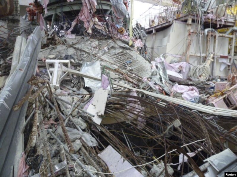
Geller is disappointed that not much has changed in Japan after March 2011 when it comes to reassessing assumptions and making new policies on disaster mitigation.
Geller had warned, before last year's magnitude 9.0 quake, that it was flawed to assume locations such as the coast of Fukushima were at lower risk for such huge temblors.
"I'm not really happy about that. I wish I hadn't been correct," he said. "There's not much pleasure in saying 'I told you so' when so many people lost their lives or their houses or the nuclear accident caused the evacuation and so on."
The cabinet office's central disaster prevention council now estimates such a big temblor could kill up to 323,000 people with most of the deaths being caused by a resulting tsunami, just as was the case in 2011. But it says, echoing something heard prior to last year's disaster, that the probability of such a powerful quake along the Nankai Trough is “extremely low.”


